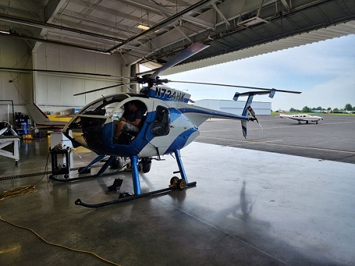
Our crews climb high in order to deliver efficient and reliable service. Sometimes, however, you must go even higher to get a bird’s eye view and make their jobs more efficient.
Liberty’s annual aerial inspection of electric transmission lines and substations began on July 24 and is scheduled for 10 days (dependent upon weather and wind conditions).
The low-flying helicopter area residents might spot is surveying approximately 1,300 miles of transmission line throughout Liberty’s local electric service territory. The focus is on identifying potential problems with transmission structures, hardware, conductors, and vegetation. An observer using an infrared camera will also be able to take a deeper look at lines, connections, and substations to identify potential areas of concern.
“It’s a quick and fast way to assess our system for potential reliability issues,” says Jason Grossman, Liberty’s Manager of Vegetation Management. “The speed and coverage we can get with a helicopter makes the process very effective.”
The infrared camera will be able to look at lines and substation connections that are “excessively hot.”
“We take that location, get a quick snapshot of what the system load is and determine what’s not functioning correctly,” he says. “We also look for any kind of visual imperfections such as broken arms and braces (on poles), the encroachment of trees, and anything else that could be a reliability issue.”

So why a helicopter over other methods of visual inspection?
“The key thing is speed and coverage,” says Grossman. “A helicopter allows for a rapid assessment we can’t get with a ground or drone patrol. The visual inspection mixed with infrared allows us to see much deeper into the system.”
